Aerial image 104878
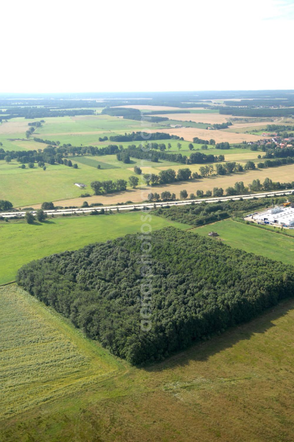
Blick auf ein quadratisch angeordnetes Mischwaldareal / Wald / Waldinsel / Waldfläche an der A9 in der Nähe des Gewerbegebiets Linthe in Brandenburg. Die Anordnung der Bäume sieht aus wie ein Quadrat.
LINTHE 27.07.2009
Aerial image ID: 104878
Image resolution: 2848 x 4288 pixels x 24 bit
compressed image file size: 3,2 MB
Image file size: 34,94 MB
Sources and credit: © euroluftbild.de/Robert Grahn
The recording is permitted due to the so-called freedom of panorama according to § 59 UrhG. The provision of Section 59 UrhG conforms to the directive based on Art. 5 Para. 3 Letter c of Directive 2001/29/EC of the European Parliament and of the Council of May 22, 2001 on the harmonization of certain aspects of copyright and related property rights in the information society ("InfoSoc-RL") to be interpreted. The directive-compliant interpretation shows that aerial photographs are also covered by § 59 Para. 1 UrhG and the use of tools does not lead out of the protective barrier. www.klebba.legal