Aerial image 118552
Blick auf die Vulkaninsel im Taal-See. Der Taal-See ist mit bis zu 172 m der tiefste See der Philippinen und entstand nach einem starken Vulkanausbruch vor mehreren hundertausend Jahren. View on Lake Taal with its volcanic crater. The Taal Lake with up to 172 m, is the deepest lake in the Philippines and developed due to a strong volcanic eruption several hundred thousand years ago.
BATANGAS 01.03.2005
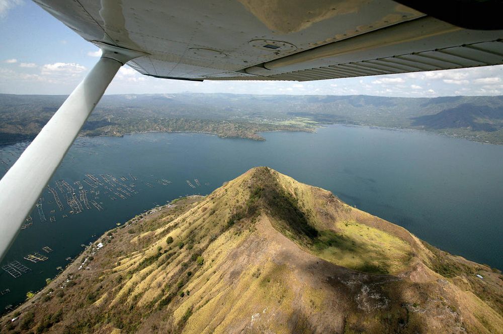
Photo: Hans Blossey
Aerial image ID: 118552
Image resolution: 5418 x 3605 pixels x 24 bit
compressed image file size: 2,05 MB
Image file size: 55,88 MB
Sources and credit: © euroluftbild.de/Hans Blossey
The recording is permitted due to the so-called freedom of panorama according to § 59 UrhG. The provision of Section 59 UrhG conforms to the directive based on Art. 5 Para. 3 Letter c of Directive 2001/29/EC of the European Parliament and of the Council of May 22, 2001 on the harmonization of certain aspects of copyright and related property rights in the information society ("InfoSoc-RL") to be interpreted. The directive-compliant interpretation shows that aerial photographs are also covered by § 59 Para. 1 UrhG and the use of tools does not lead out of the protective barrier. www.klebba.legal