Aerial photograph 515765
Course of the Ahr and oil-polluted fish pond after the flood disaster in the Ahr valley this year near Dernau in the state Rhineland-Palatinate, Germany
DERNAU 15.08.2021
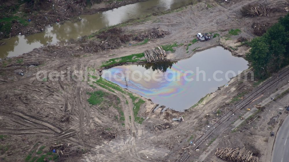
Course of the Ahr and oil-polluted fish pond after the flood disaster in the Ahr valley this year near Dernau in the state Rhineland-Palatinate, Germany. Further information at: Ahrtal-Tourismus Bad Neuenahr-Ahrweiler e.V., WeinKulturDorf Dernau e. V.. www.ahrtal.de / www.dernau.de Photo: Klaus Göhring
Aerial image ID: 515765
Image resolution: 6016 x 3384 pixels x 24 bit
compressed image file size: 9,05 MB
Image file size: 58,25 MB
Sources and credit: © euroluftbild.de/Klaus Göhring
The recording is permitted due to the so-called freedom of panorama according to § 59 UrhG. The provision of Section 59 UrhG conforms to the directive based on Art. 5 Para. 3 Letter c of Directive 2001/29/EC of the European Parliament and of the Council of May 22, 2001 on the harmonization of certain aspects of copyright and related property rights in the information society ("InfoSoc-RL") to be interpreted. The directive-compliant interpretation shows that aerial photographs are also covered by § 59 Para. 1 UrhG and the use of tools does not lead out of the protective barrier. www.klebba.legal
Position: 50° 31' 59.6'' N / 7° 3' 10.15'' E