Aerial image 468860
Curved loop of the riparian zones on the course of the river Donau near the mountain " Szent Mihaly-hegy " in the district Gizellatelep in Visegrad in Komitat Pest, Hungary
VISEGRAD 10.03.2014
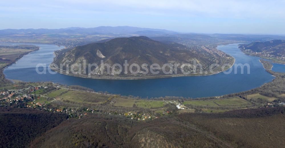
Curved loop of the riparian zones on the course of the river Donau near the mountain " Szent Mihaly-hegy " in the district Gizellatelep in Visegrad in Komitat Pest, Hungary. Photo: Civertan Bt.
Aerial image ID: 468860
Image resolution: 7360 x 3844 pixels x 24 bit
compressed image file size: 6,14 MB
Image file size: 80,94 MB
Sources and credit: © euroluftbild.de/Civertan Bt.
The recording is permitted due to the so-called freedom of panorama according to § 59 UrhG. The provision of Section 59 UrhG conforms to the directive based on Art. 5 Para. 3 Letter c of Directive 2001/29/EC of the European Parliament and of the Council of May 22, 2001 on the harmonization of certain aspects of copyright and related property rights in the information society ("InfoSoc-RL") to be interpreted. The directive-compliant interpretation shows that aerial photographs are also covered by § 59 Para. 1 UrhG and the use of tools does not lead out of the protective barrier.
Position: 47° 45' 47.59'' N / 18° 56' 14.42'' E