Aerial image 592646
Curved loops of several converging rivers flowing into the Wadden Sea on the green environmentally protected North Sea island Memmert in Juist and the sandbank Kachelotplate in the state Lower Saxony
JUIST 09.10.2022
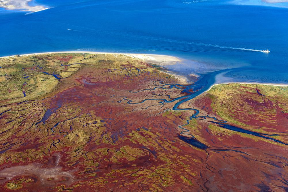
Curved loops of several converging rivers flowing into the Wadden Sea on the green environmentally protected North Sea island Memmert in Juist and the sandbank Kachelotplate in the state Lower Saxony. www.nlwkn.niedersachsen.de Photo: Martin Elsen
Aerial image ID: 592646
Image resolution: 8256 x 5504 pixels x 24 bit
compressed image file size: 41,4 MB
Image file size: 130,01 MB
Sources and credit: © euroluftbild.de/Martin Elsen
The recording is permitted due to the so-called freedom of panorama according to § 59 UrhG. The provision of Section 59 UrhG conforms to the directive based on Art. 5 Para. 3 Letter c of Directive 2001/29/EC of the European Parliament and of the Council of May 22, 2001 on the harmonization of certain aspects of copyright and related property rights in the information society ("InfoSoc-RL") to be interpreted. The directive-compliant interpretation shows that aerial photographs are also covered by § 59 Para. 1 UrhG and the use of tools does not lead out of the protective barrier. www.klebba.legal
Position: 53° 37' 56.93'' N / 6° 52' 49.76'' E