Aerial photograph 448303
Development area and building land fallow Berliner Dom - Karl-Liebknecht-Strasse - Schlossbruecke - Schlossplatz in the district Mitte in Berlin, Germany
BERLIN 01.03.1965
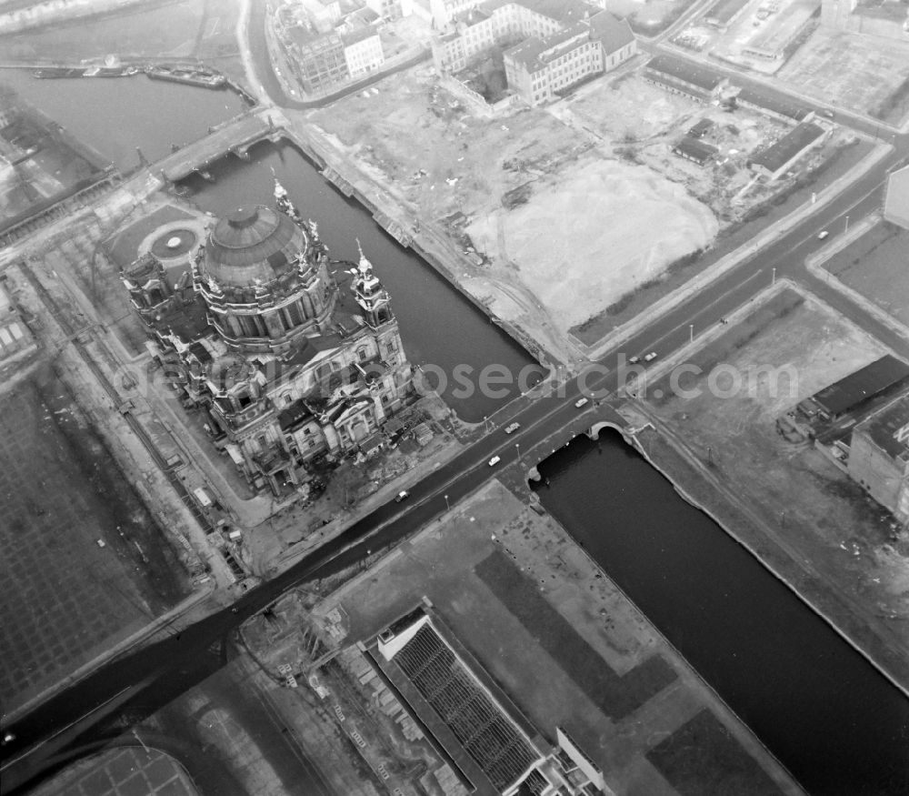
Development area and building land fallow Berliner Dom - Karl-Liebknecht-Strasse - Schlossbruecke - Schlossplatz in the district Mitte in Berlin, Germany. Photo: Lothar Willmann
Aerial image ID: 448303
Image resolution: 5148 x 4513 pixels x 8 bit
compressed image file size: 4,73 MB
Image file size: 22,16 MB
Sources and credit: © euroluftbild.de/Lothar Willmann
All information gathered here in picture and word represent a non-binding information offer to you, which was compiled from trustworthy media. Objections or correction notes please to info@euroluftbild.de - Media licenses according to MfM table!
Position: 52° 31' 6.06'' N / 13° 24' 9.44'' E
Keywords
#Berlin
#aerial photo
#aerial photography
#aerial picture
#aerial view
#air photo
#Europe
#Germany
#Mitte
#Premises
#property
#district
#area
#residential area
#House
#wasteland
#vacancy
#standstill
#location
#workplace
#infrastructure
#building
#development area
#use
#planning
#perspective
#GDR
#German Democratic Republic
#historical
#socialism
#planned economy
#East Berlin
#postwar period
#reconstruction
#model
#role model
#architecture
#presentation
#system
#competition