Aerial image 597458
Development area and building land fallow on Wesel-Datteln-Kanal on street Droste-Huelshoff-Strasse in the district Hardt in Dorsten at Ruhrgebiet in the state North Rhine-Westphalia, Germany
DORSTEN 10.06.2022
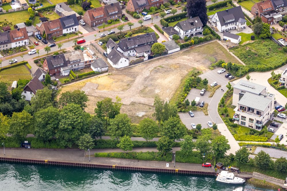
Development area and building land fallow on Wesel-Datteln-Kanal on street Droste-Huelshoff-Strasse in the district Hardt in Dorsten at Ruhrgebiet in the state North Rhine-Westphalia, Germany. Photo: Hans Blossey
Aerial image ID: 597458
Image resolution: 8760 x 5843 pixels x 24 bit
compressed image file size: 30,26 MB
Image file size: 146,44 MB
Sources and credit: © euroluftbild.de/Hans Blossey
The recording is permitted due to the so-called freedom of panorama according to § 59 UrhG. The provision of Section 59 UrhG conforms to the directive based on Art. 5 Para. 3 Letter c of Directive 2001/29/EC of the European Parliament and of the Council of May 22, 2001 on the harmonization of certain aspects of copyright and related property rights in the information society ("InfoSoc-RL") to be interpreted. The directive-compliant interpretation shows that aerial photographs are also covered by § 59 Para. 1 UrhG and the use of tools does not lead out of the protective barrier. www.klebba.legal
Position: 51° 39' 48'' N / 6° 57' 24'' E