Aerial image 151142
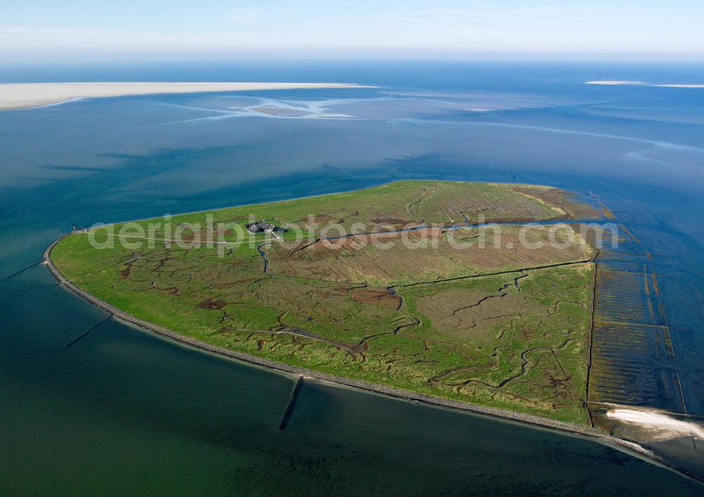
Die Insel Süderoog (friesisch Saruug, Saaruuch) ist eine Hallig im nordfriesischen Wattenmeer, vor der Westküste von Schleswig-Holstein. Sie gehört verwaltungsmäßig zur Gemeinde Pellworm und ist ein Vogelschutzgebiet. The island Süderoog is a holm in the North Frisian Wadden Sea, off the west coast of Schleswig-Holstein.
SÜDERDEROOG 18.10.2005
Aerial image ID: 151142
Image resolution: 5433 x 3839 pixels x 24 bit
compressed image file size: 8,45 MB
Image file size: 59,67 MB
Sources and credit: © euroluftbild.de/Gerhard Launer
The recording is permitted due to the so-called freedom of panorama according to § 59 UrhG. The provision of Section 59 UrhG conforms to the directive based on Art. 5 Para. 3 Letter c of Directive 2001/29/EC of the European Parliament and of the Council of May 22, 2001 on the harmonization of certain aspects of copyright and related property rights in the information society ("InfoSoc-RL") to be interpreted. The directive-compliant interpretation shows that aerial photographs are also covered by § 59 Para. 1 UrhG and the use of tools does not lead out of the protective barrier. www.klebba.legal