Aerial image 181898
Flood level - situation from flooding and overflow of the banks of the Elbe along the Lower course at Sandau (Elbe) in Saxony-Anhalt
SANDAU 10.06.2013
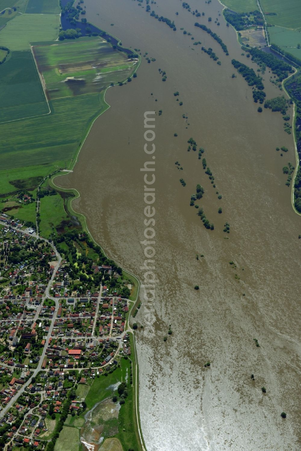
Flood level - situation from flooding and overflow of the banks of the Elbe along the Lower course at Sandau (Elbe) in Saxony-Anhalt.
Aerial image ID: 181898
Image resolution: 4912 x 7360 pixels x 24 bit
compressed image file size: 6,36 MB
Image file size: 103,43 MB
Sources and credit: © euroluftbild.de/Robert Grahn
The recording is permitted due to the so-called freedom of panorama according to § 59 UrhG. The provision of Section 59 UrhG conforms to the directive based on Art. 5 Para. 3 Letter c of Directive 2001/29/EC of the European Parliament and of the Council of May 22, 2001 on the harmonization of certain aspects of copyright and related property rights in the information society ("InfoSoc-RL") to be interpreted. The directive-compliant interpretation shows that aerial photographs are also covered by § 59 Para. 1 UrhG and the use of tools does not lead out of the protective barrier. www.klebba.legal
Position: 52° 48' 20.64'' N / 12° 2' 41.17'' E