Aerial image 622104
Highway route of the BAB AB A45 at the blown-up " Talbruecke Rahmede " near in Oberrahmede in the state North Rhine-Westphalia, Germany
OBERRAHMEDE 26.09.2023
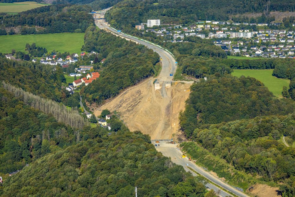
Highway route of the BAB AB A45 at the blown-up " Talbruecke Rahmede " near in Oberrahmede in the state North Rhine-Westphalia, Germany. Further information at: Autobahn GmbH des Bundes Niederlassung Westfalen. www.autobahn.de Photo: Hans Blossey
Aerial image ID: 622104
Image resolution: 9999 x 6669 pixels x 24 bit
compressed image file size: 34,32 MB
Image file size: 190,78 MB
Sources and credit: © euroluftbild.de/Hans Blossey
The recording is permitted due to the so-called freedom of panorama according to § 59 UrhG. The provision of Section 59 UrhG conforms to the directive based on Art. 5 Para. 3 Letter c of Directive 2001/29/EC of the European Parliament and of the Council of May 22, 2001 on the harmonization of certain aspects of copyright and related property rights in the information society ("InfoSoc-RL") to be interpreted. The directive-compliant interpretation shows that aerial photographs are also covered by § 59 Para. 1 UrhG and the use of tools does not lead out of the protective barrier. www.klebba.legal
Position: 51° 14' 58.69'' N / 7° 37' 13.91'' E