Aerial image 503864
Markings for the route of the planned gas pipeline in the district Holthausen in Voerde at Ruhrgebiet in the state North Rhine-Westphalia, Germany
VOERDE 30.03.2021
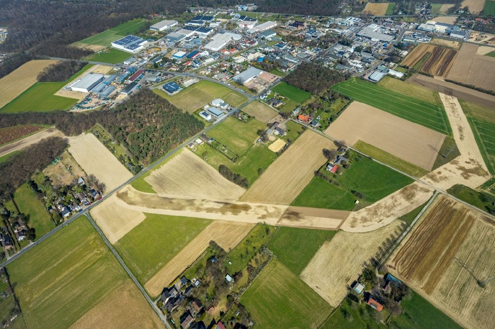
Markings for the route of the planned gas pipeline in the district Holthausen in Voerde at Ruhrgebiet in the state North Rhine-Westphalia, Germany. Further information at: Zeelink GmbH & Co. KG. www.zeelink.de Photo: Hans Blossey
Aerial image ID: 503864
Image resolution: 8192 x 5461 pixels x 24 bit
compressed image file size: 21,91 MB
Image file size: 127,99 MB
Sources and credit: © euroluftbild.de/Hans Blossey
The recording is permitted due to the so-called freedom of panorama according to § 59 UrhG. The provision of Section 59 UrhG conforms to the directive based on Art. 5 Para. 3 Letter c of Directive 2001/29/EC of the European Parliament and of the Council of May 22, 2001 on the harmonization of certain aspects of copyright and related property rights in the information society ("InfoSoc-RL") to be interpreted. The directive-compliant interpretation shows that aerial photographs are also covered by § 59 Para. 1 UrhG and the use of tools does not lead out of the protective barrier. www.klebba.legal
Position: 51° 36' 41.62'' N / 6° 40' 21.35'' E