Aerial Photo Database
Fulltext
  • Fulltext
  • Place

Search for place, image id, term(s)

Only search for place

Aerial image 125034
Minsener Oog 27. 07. 2006 Das Eiland Minsener Oog gehört zu den Ostfriesischen Inseln und liegt zwischen Mellum und Wangerooge. Es kann von Horumersiel-Schilling per Wattwan derung erreicht werden und ist für Besucher geöffnet. The island Minsener Oog is part of the East Frisisan Islands and is located between Mellum and Wangerooge. People can go to the island Minsener Oog through the mud flats.

MINSENER OOG 27.07.2006
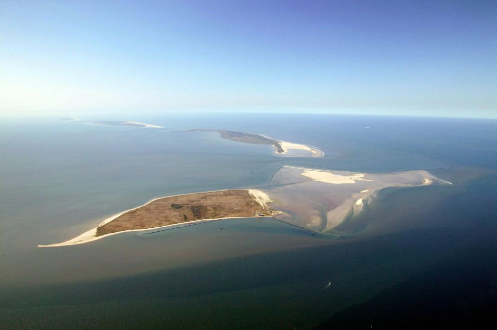
Minsener Oog from above - Minsener Oog 27. 07. 2006 Das Eiland Minsener Oog gehört zu den Ostfriesischen Inseln und liegt zwischen Mellum und Wangerooge. Es kann von Horumersiel-Schilling per Wattwan derung erreicht werden und ist für Besucher geöffnet. The island Minsener Oog is part of the East Frisisan Islands and is located between Mellum and Wangerooge. People can go to the island Minsener Oog through the mud flats.
Thematically related aerial photos
https://www.aerialphotosearch.com/info/aerial-photos/minsener-oog-eiland-minsener-oog-gehrt-ostfriesischen-inseln-liegt-zwischen-mellum-wangerooge-kann-horumersiel-schilling-per-wattwan-derung-erreicht-werden-ist-besucher-geffnet-island-minsener-oog-part-east-frisisan-islands-located-between-mellum-wangerooge-people-can-island-minsener-oog-through-mud-flats-125034.html https://www.aerialphotosearch.com/info/aerial-photos/minsener-oog-eiland-minsener-oog-gehrt-ostfriesischen-inseln-liegt-zwischen-mellum-wangerooge-kann-horumersiel-schilling-per-wattwan-derung-erreicht-werden-ist-besucher-geffnet-island-minsener-oog-part-east-frisisan-islands-located-between-mellum-wangerooge-people-can-island-minsener-oog-through-mud-flats-125034.html

Photo: Hans Blossey

Aerial image ID: 125034
Image resolution: 5669 x 3772 pixels x 24 bit
compressed image file size: 2,39 MB
Image file size: 61,18 MB
Sources and credit: © euroluftbild.de/Hans Blossey

The recording is permitted due to the so-called freedom of panorama according to § 59 UrhG. The provision of Section 59 UrhG conforms to the directive based on Art. 5 Para. 3 Letter c of Directive 2001/29/EC of the European Parliament and of the Council of May 22, 2001 on the harmonization of certain aspects of copyright and related property rights in the information society ("InfoSoc-RL") to be interpreted. The directive-compliant interpretation shows that aerial photographs are also covered by § 59 Para. 1 UrhG and the use of tools does not lead out of the protective barrier. www.klebba.legal

Keywords