Aerial photograph 597865
Routing and lanes in the course of the motorway bridge of the BAB A 46 " Neue Ruhrtalbruecke Bermecke " near Olsberg in the state North Rhine-Westphalia, Germany
OLSBERG 16.03.2020
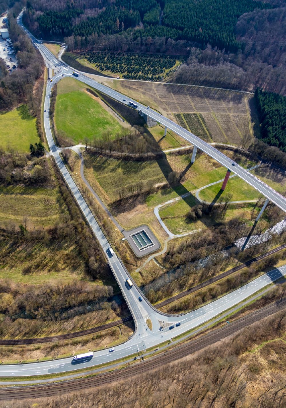
Routing and lanes in the course of the motorway bridge of the BAB A 46 " Neue Ruhrtalbruecke Bermecke " near Olsberg in the state North Rhine-Westphalia, Germany. Further information at: Autobahn GmbH des Bundes Niederlassung Westfalen, Fritz Meyer GmbH. www.meyer-bauunternehmung.de / www.autobahn.de Photo: Hans Blossey
Aerial image ID: 597865
Image resolution: 4718 x 6720 pixels x 24 bit
compressed image file size: 16,03 MB
Image file size: 90,71 MB
Sources and credit: © euroluftbild.de/Hans Blossey
The recording is permitted due to the so-called freedom of panorama according to § 59 UrhG. The provision of Section 59 UrhG conforms to the directive based on Art. 5 Para. 3 Letter c of Directive 2001/29/EC of the European Parliament and of the Council of May 22, 2001 on the harmonization of certain aspects of copyright and related property rights in the information society ("InfoSoc-RL") to be interpreted. The directive-compliant interpretation shows that aerial photographs are also covered by § 59 Para. 1 UrhG and the use of tools does not lead out of the protective barrier. www.klebba.legal
Position: 51° 21' 55.61'' N / 8° 26' 49.37'' E