Aerial photograph 494099
Routing and lanes in the course of the motorway exit and access to the BAB A26 in Horneburg in the state Lower Saxony, Germany
HORNEBURG 17.06.2020
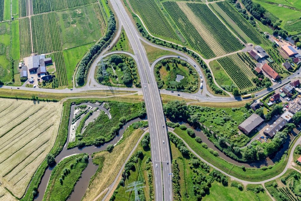
Routing and lanes in the course of the motorway exit and access to the BAB A26 in Horneburg in the state Lower Saxony, Germany. Photo: Martin Elsen
Aerial image ID: 494099
Image resolution: 7493 x 4995 pixels x 24 bit
compressed image file size: 45,99 MB
Image file size: 107,08 MB
Sources and credit: © euroluftbild.de/Martin Elsen
The recording is permitted due to the so-called freedom of panorama according to § 59 UrhG. The provision of Section 59 UrhG conforms to the directive based on Art. 5 Para. 3 Letter c of Directive 2001/29/EC of the European Parliament and of the Council of May 22, 2001 on the harmonization of certain aspects of copyright and related property rights in the information society ("InfoSoc-RL") to be interpreted. The directive-compliant interpretation shows that aerial photographs are also covered by § 59 Para. 1 UrhG and the use of tools does not lead out of the protective barrier. www.klebba.legal
Position: 53° 30' 46.28'' N / 9° 35' 26.27'' E