Aerial photograph 241743
Shore areas of the Upper pond in Donaueschingen in Baden - Wuerttemberg. Through the nature reserve and the lake flows the Wolfsbach, that empties into the Breg and then united with the river Brigach gets the Danube
DONAUESCHINGEN 24.06.2015
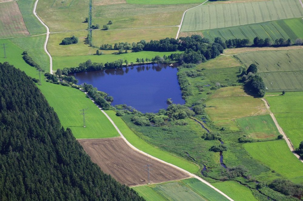
Shore areas of the Upper pond in Donaueschingen in Baden - Wuerttemberg. Through the nature reserve and the lake flows the Wolfsbach, that empties into the Breg and then united with the river Brigach gets the Danube. Photo: Erich Meyer
Aerial image ID: 241743
Image resolution: 4368 x 2912 pixels x 24 bit
compressed image file size: 7,14 MB
Image file size: 36,39 MB
Sources and credit: © euroluftbild.de/Erich Meyer
The recording is permitted due to the so-called freedom of panorama according to § 59 UrhG. The provision of Section 59 UrhG conforms to the directive based on Art. 5 Para. 3 Letter c of Directive 2001/29/EC of the European Parliament and of the Council of May 22, 2001 on the harmonization of certain aspects of copyright and related property rights in the information society ("InfoSoc-RL") to be interpreted. The directive-compliant interpretation shows that aerial photographs are also covered by § 59 Para. 1 UrhG and the use of tools does not lead out of the protective barrier. www.klebba.legal
Position: 47° 59' 8.62'' N / 8° 25' 22.47'' E