Aerial photograph 373185
Shore areas with flooded by flood level riverbed of the Rhine river in Rees in the state North Rhine-Westphalia, Germany
REES 18.04.1994
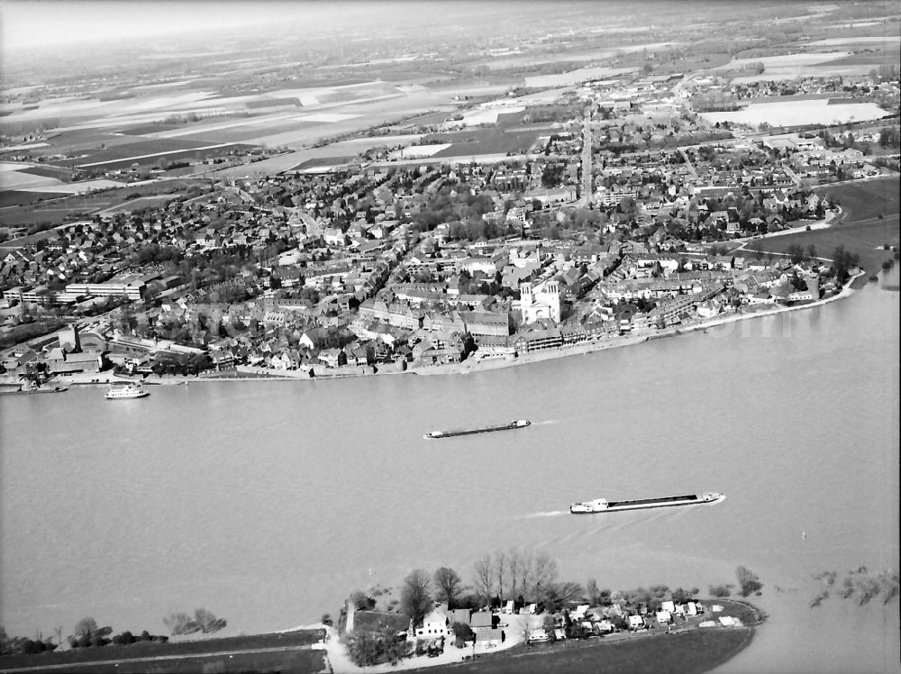
Shore areas with flooded by flood level riverbed of the Rhine river in Rees in the state North Rhine-Westphalia, Germany. Photo: Elmar Hartmann
Aerial image ID: 373185
Image resolution: 4016 x 3006 pixels x 8 bit
compressed image file size: 1,71 MB
Image file size: 11,51 MB
Sources and credit: © euroluftbild.de/Elmar Hartmann
The recording is permitted due to the so-called freedom of panorama according to § 59 UrhG. The provision of Section 59 UrhG conforms to the directive based on Art. 5 Para. 3 Letter c of Directive 2001/29/EC of the European Parliament and of the Council of May 22, 2001 on the harmonization of certain aspects of copyright and related property rights in the information society ("InfoSoc-RL") to be interpreted. The directive-compliant interpretation shows that aerial photographs are also covered by § 59 Para. 1 UrhG and the use of tools does not lead out of the protective barrier. www.klebba.legal
Position: 51° 42' 51.31'' N / 6° 25' 47.38'' E