Aerial image 221560
The Eider flood barrier in Toenning in the state of Schleswig-Holstein. The barrage is located on the mouth of the river Eider, going into the North Sea. The barrier is in place for protection against storm flooding of the North Sea. It was built in 1967, consisting of 2 rows with 5 gates each to provide double flooding protection. The landscape along the riverbank of the Eider consists of agricultural fields
WESSELBURENERKOOG 03.06.2010
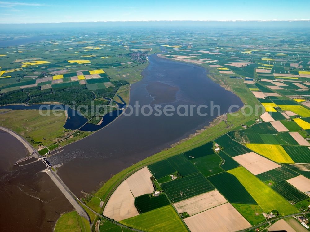
The Eider flood barrier in Toenning in the state of Schleswig-Holstein. The barrage is located on the mouth of the river Eider, going into the North Sea. The barrier is in place for protection against storm flooding of the North Sea. It was built in 1967, consisting of 2 rows with 5 gates each to provide double flooding protection. The landscape along the riverbank of the Eider consists of agricultural fields. www.wsv.de Photo: Gerhard Launer
Aerial image ID: 221560
Image resolution: 7216 x 5412 pixels x 24 bit
compressed image file size: 15,56 MB
Image file size: 111,73 MB
Sources and credit: © euroluftbild.de/Gerhard Launer
The recording is permitted due to the so-called freedom of panorama according to § 59 UrhG. The provision of Section 59 UrhG conforms to the directive based on Art. 5 Para. 3 Letter c of Directive 2001/29/EC of the European Parliament and of the Council of May 22, 2001 on the harmonization of certain aspects of copyright and related property rights in the information society ("InfoSoc-RL") to be interpreted. The directive-compliant interpretation shows that aerial photographs are also covered by § 59 Para. 1 UrhG and the use of tools does not lead out of the protective barrier. www.klebba.legal
Position: 54° 15' 39.64'' N / 8° 50' 53.21'' E