Aerial photograph 200635
The Grane barrage fixe in Langelsheim in the state of Lower Saxony. The barrage is located on the river Grane North of the Astfeld part of the town. It was built in 1969 and is the youngest of the dams in the Harz region. It is used for drinking water supply, flood protection and for power generation. Watersports are forbidden but there is a cycling and hiking trail around the lake
LANGELSHEIM 15.07.2007
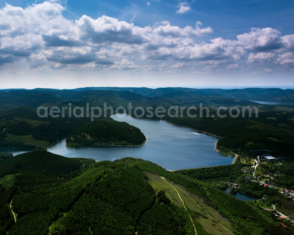
The Grane barrage fixe in Langelsheim in the state of Lower Saxony. The barrage is located on the river Grane North of the Astfeld part of the town. It was built in 1969 and is the youngest of the dams in the Harz region. It is used for drinking water supply, flood protection and for power generation. Watersports are forbidden but there is a cycling and hiking trail around the lake. www.harzwasserwerke.de Photo: Gerhard Launer
Aerial image ID: 200635
Image resolution: 5906 x 4724 pixels x 24 bit
compressed image file size: 6,84 MB
Image file size: 79,82 MB
Sources and credit: © euroluftbild.de/Gerhard Launer
The recording is permitted due to the so-called freedom of panorama according to § 59 UrhG. The provision of Section 59 UrhG conforms to the directive based on Art. 5 Para. 3 Letter c of Directive 2001/29/EC of the European Parliament and of the Council of May 22, 2001 on the harmonization of certain aspects of copyright and related property rights in the information society ("InfoSoc-RL") to be interpreted. The directive-compliant interpretation shows that aerial photographs are also covered by § 59 Para. 1 UrhG and the use of tools does not lead out of the protective barrier. www.klebba.legal