Aerial image 202518
The Partensteiner Forest in the Spessart region in the borough of Partenstein in the state of Bavaria. Its highest point is the Weickertshöhe. The Spessart region is a mountain range in Southern Germany in the states of Bavaria and Hesse. The Spessart was used as a royal hunting ground, but today it is mostly important for the local tourism and as a recreational region. The region consists of 2440 square kilometres
PARTENSTEIN 13.09.2007
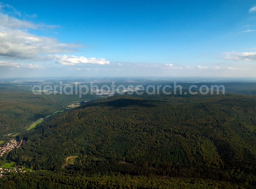
The Partensteiner Forest in the Spessart region in the borough of Partenstein in the state of Bavaria. Its highest point is the Weickertshöhe. The Spessart region is a mountain range in Southern Germany in the states of Bavaria and Hesse. The Spessart was used as a royal hunting ground, but today it is mostly important for the local tourism and as a recreational region. The region consists of 2440 square kilometres. www.spessartbund.de / www.naturpark-spessart.de Photo: Gerhard Launer
Aerial image ID: 202518
Image resolution: 7205 x 5315 pixels x 24 bit
compressed image file size: 11,67 MB
Image file size: 109,56 MB
Sources and credit: © euroluftbild.de/Gerhard Launer
The recording is permitted due to the so-called freedom of panorama according to § 59 UrhG. The provision of Section 59 UrhG conforms to the directive based on Art. 5 Para. 3 Letter c of Directive 2001/29/EC of the European Parliament and of the Council of May 22, 2001 on the harmonization of certain aspects of copyright and related property rights in the information society ("InfoSoc-RL") to be interpreted. The directive-compliant interpretation shows that aerial photographs are also covered by § 59 Para. 1 UrhG and the use of tools does not lead out of the protective barrier. www.klebba.legal