Aerial image 434026
The Ujscie Warty National Park, also, Warta River Mouth National Park. It was created on June 19, 2001, in the region of the lowest stretch of the Warta river, up to its confluence with the Odra, which marks the Polisha??German border. The Park covers an area of 80.38 square kilometres within Lubusz Voivodeship
KOSTRZYN NAD ODRA 17.10.2019
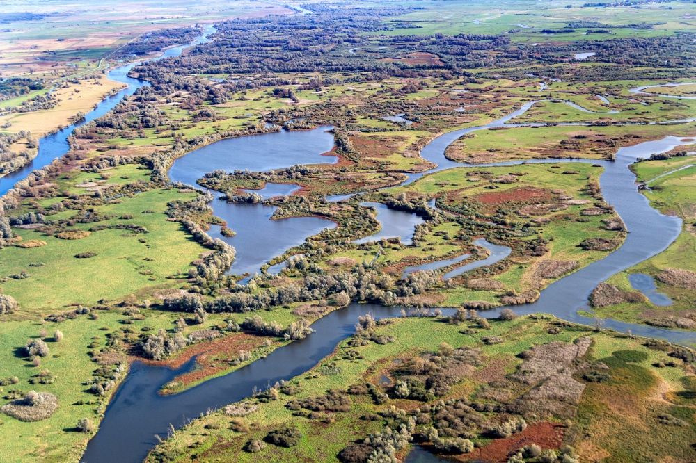
The Ujscie Warty National Park, also, Warta River Mouth National Park. It was created on June 19, 2001, in the region of the lowest stretch of the Warta river, up to its confluence with the Odra, which marks the Polisha??German border. The Park covers an area of 80.38 square kilometres within Lubusz Voivodeship. Photo: Bernd Clemens
Aerial image ID: 434026
Image resolution: 5184 x 3456 pixels x 24 bit
compressed image file size: 9,81 MB
Image file size: 51,26 MB
Sources and credit: © euroluftbild.de/Bernd Clemens
The recording is permitted due to the so-called freedom of panorama according to § 59 UrhG. The provision of Section 59 UrhG conforms to the directive based on Art. 5 Para. 3 Letter c of Directive 2001/29/EC of the European Parliament and of the Council of May 22, 2001 on the harmonization of certain aspects of copyright and related property rights in the information society ("InfoSoc-RL") to be interpreted. The directive-compliant interpretation shows that aerial photographs are also covered by § 59 Para. 1 UrhG and the use of tools does not lead out of the protective barrier. www.klebba.legal
Position: 52° 34' 48.23'' N / 14° 42' 6.05'' E