Aerial photograph 610941
View of the construction site of the city development area Baakenhafen on the Elbe in Hamburg. Since the resolution of the Senate in 1998, the harbor and the surrounding headlands are formally part of the project HafenCity, where the port areas released south of the city center of Hamburg from its original use and to be converted to retail, commercial, residential and leisure-related areas
HAMBURG 19.05.2023
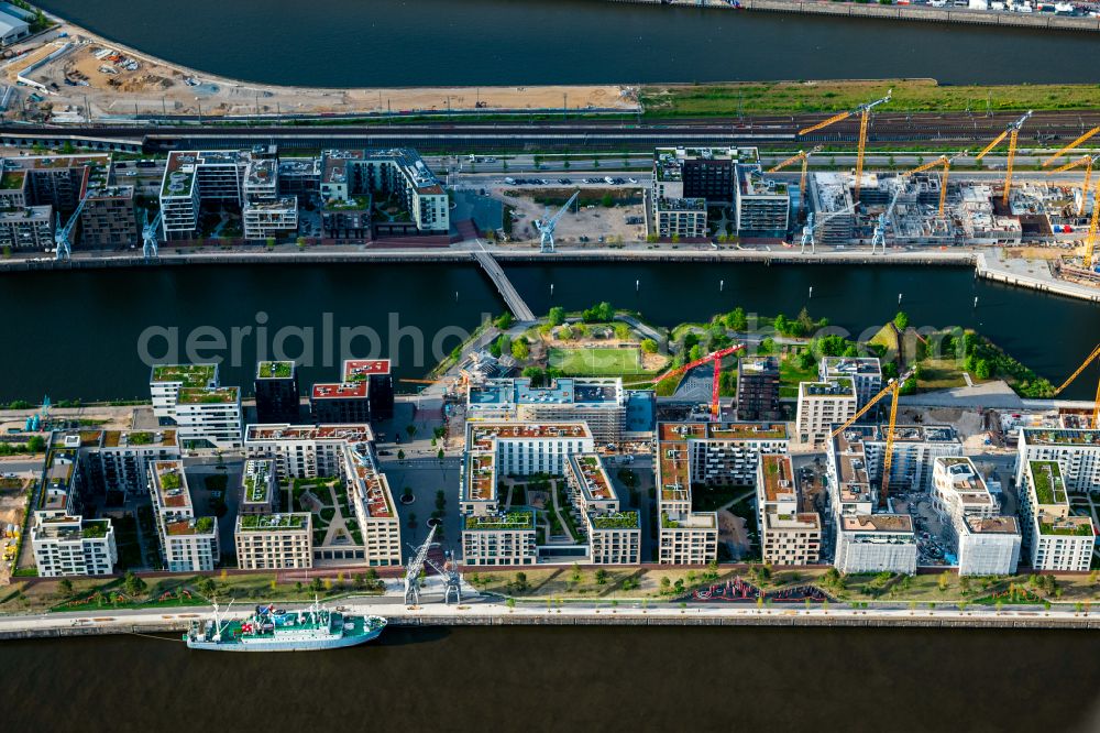
View of the construction site of the city development area Baakenhafen on the Elbe in Hamburg. Since the resolution of the Senate in 1998, the harbor and the surrounding headlands are formally part of the project HafenCity, where the port areas released south of the city center of Hamburg from its original use and to be converted to retail, commercial, residential and leisure-related areas. www.apb-architekten.de / www.hafencity.com Photo: Tobias Barth
Aerial image ID: 610941
Image resolution: 5348 x 3570 pixels x 24 bit
compressed image file size: 8,17 MB
Image file size: 54,62 MB
Sources and credit: © euroluftbild.de/Tobias Barth
The recording is permitted due to the so-called freedom of panorama according to § 59 UrhG. The provision of Section 59 UrhG conforms to the directive based on Art. 5 Para. 3 Letter c of Directive 2001/29/EC of the European Parliament and of the Council of May 22, 2001 on the harmonization of certain aspects of copyright and related property rights in the information society ("InfoSoc-RL") to be interpreted. The directive-compliant interpretation shows that aerial photographs are also covered by § 59 Para. 1 UrhG and the use of tools does not lead out of the protective barrier. www.klebba.legal
Position: 53° 32' 16.31'' N / 10° 0' 55.06'' E