Aerial image 163416
View of the highway Westway in West London. The road Westway is a 4 kilometer long section of the A40 route. It runs from Paddington to North Kensington and was built from 1964 to 1970 in order to relieve congestion at Stepherd's Bush caused by traffic from Western Avenue
LONDON 20.06.2012
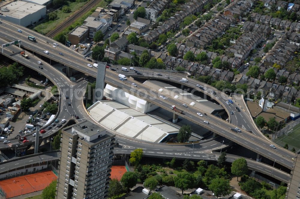
View of the highway Westway in West London. The road Westway is a 4 kilometer long section of the A40 route. It runs from Paddington to North Kensington and was built from 1964 to 1970 in order to relieve congestion at Stepherd's Bush caused by traffic from Western Avenue.
Aerial image ID: 163416
Image resolution: 4288 x 2848 pixels x 24 bit
compressed image file size: 4 MB
Image file size: 34,94 MB
Sources and credit: © euroluftbild.de/Robert Grahn
The recording is permitted due to the so-called freedom of panorama according to § 59 UrhG. The provision of Section 59 UrhG conforms to the directive based on Art. 5 Para. 3 Letter c of Directive 2001/29/EC of the European Parliament and of the Council of May 22, 2001 on the harmonization of certain aspects of copyright and related property rights in the information society ("InfoSoc-RL") to be interpreted. The directive-compliant interpretation shows that aerial photographs are also covered by § 59 Para. 1 UrhG and the use of tools does not lead out of the protective barrier. www.klebba.legal
Position: 51° 30' 54.89'' N / 0° 13' 14.96'' W