Aerial photograph 616637
Vertical aerial view from the satellite perspective of the building complex of the university of applied sciences Rhein-Waal on street Ringstrasse in the district Kamperbruch in Kamp-Lintfort in the state of North Rhine-Westphalia
KAMP-LINTFORT 11.07.2023
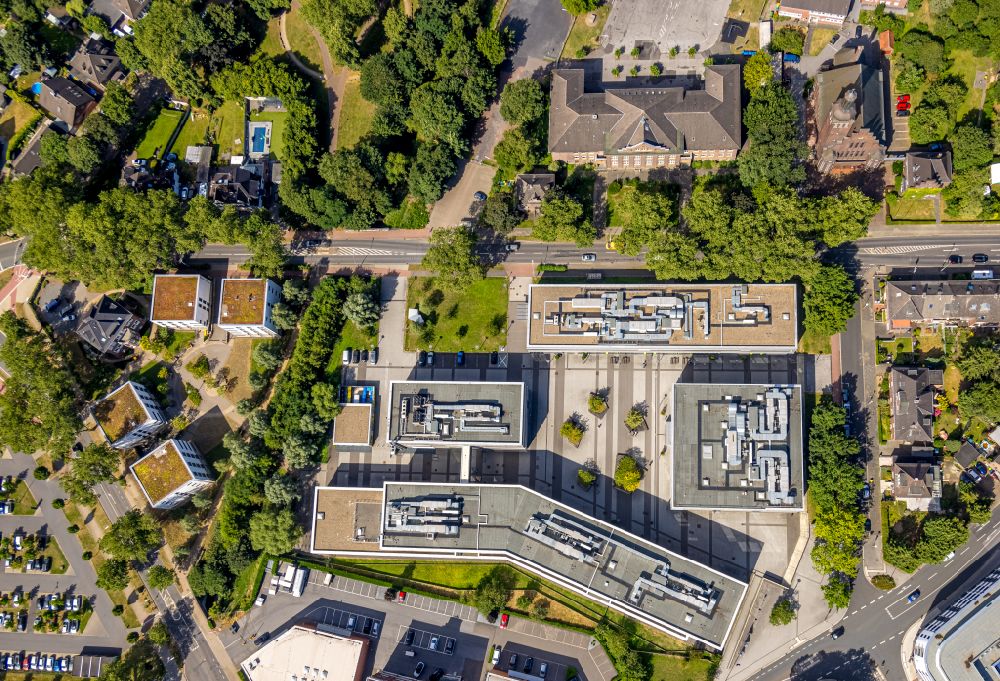
Vertical aerial view from the satellite perspective of the building complex of the university of applied sciences Rhein-Waal on street Ringstrasse in the district Kamperbruch in Kamp-Lintfort in the state of North Rhine-Westphalia. Further information at: Hochschule Rhein-Waal, pbr Planungsbuero Rohling AG. www.pbr.de Photo: Hans Blossey
Aerial image ID: 616637
Image resolution: 8760 x 5978 pixels x 24 bit
compressed image file size: 23,13 MB
Image file size: 149,82 MB
Sources and credit: © euroluftbild.de/Hans Blossey
The recording is permitted due to the so-called freedom of panorama according to § 59 UrhG. The provision of Section 59 UrhG conforms to the directive based on Art. 5 Para. 3 Letter c of Directive 2001/29/EC of the European Parliament and of the Council of May 22, 2001 on the harmonization of certain aspects of copyright and related property rights in the information society ("InfoSoc-RL") to be interpreted. The directive-compliant interpretation shows that aerial photographs are also covered by § 59 Para. 1 UrhG and the use of tools does not lead out of the protective barrier. www.klebba.legal
Position: 51° 30' 1.48'' N / 6° 32' 45.12'' E