Aerial photograph 136111
Vertical aerial view from the satellite perspective of the traffic flow at the intersection- motorway A 4 and A9 "Hermsdorfer Kreuz" in Hermsdorf in the state Thuringia, Germany
HERMSDORF 06.05.2011
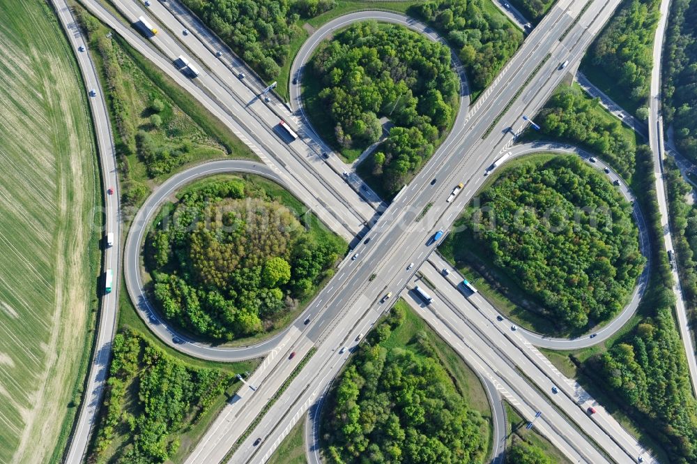
Vertical aerial view from the satellite perspective of the traffic flow at the intersection- motorway A 4 and A9 "Hermsdorfer Kreuz" in Hermsdorf in the state Thuringia, Germany. Photo: Robert Grahn
Aerial image ID: 136111
Image resolution: 4256 x 2832 pixels x 24 bit
compressed image file size: 4,25 MB
Image file size: 34,48 MB
Sources and credit: © euroluftbild.de/Robert Grahn
The recording is permitted due to the so-called freedom of panorama according to § 59 UrhG. The provision of Section 59 UrhG conforms to the directive based on Art. 5 Para. 3 Letter c of Directive 2001/29/EC of the European Parliament and of the Council of May 22, 2001 on the harmonization of certain aspects of copyright and related property rights in the information society ("InfoSoc-RL") to be interpreted. The directive-compliant interpretation shows that aerial photographs are also covered by § 59 Para. 1 UrhG and the use of tools does not lead out of the protective barrier. www.klebba.legal
Position: 50° 52' 48.01'' N / 11° 50' 48.08'' E